Trail Walking La Forteresse - Autour de LA FORTERESSE  - Photo
© OpenStreetMap contributors
Length
Length
16.7 km
Max alt
Max alt
780 m
Uphill gradient
Uphill gradient
579 m
Km-Effort
Km-Effort  
24 km
Min alt
Min alt
532 m
Downhill gradient
Downhill gradient
575 m
Boucle
Boucle
Yes
Creation date :
2024-04-10 07:23:27.417
Updated on :
2024-04-10 13:08:15.211

(0 Reviews)

Walking
Walking
4h30
Difficulty : Easy

Scan this QR Code to open this trail in the SityTrail application

FREE GPS app for hiking

Logo SityTrail SityTrail

IGN / Geographical institutes

Download SityTrail from the App Store Download SityTrail from Google Play

Logo SityTrail SityTrail World

The world is yours!

Download SityTrail from the App Store Download SityTrail from Google Play Download SityTrail on Huawei AppGallery

About

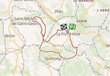
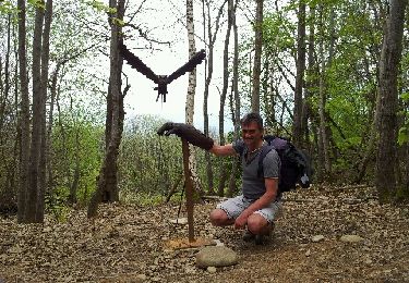
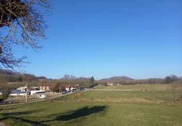
Trail Walking of 16.7 km to be discovered at Auvergne-Rhône-Alpes, Isère, La Forteresse. This trail is proposed by Marco Paulo.

Description

Ballade dans les collines sans difficulté.

Elevation profile

Positioning

Country:
France
Region :
Auvergne-Rhône-Alpes
Department/Province :
Isère
Municipality :
La Forteresse
Location:
Unknown
Start:(UTM)
688419 ; 5018536 (31T) N.

Trails nearby

Trail Walking La Forteresse - Croix de Baron - Photo
Walking
raymondfn

Walking

Medium
(2)
La Forteresse, Auvergne-Rhône-Alpes, Isère, France
9.6 km | 13.2 km-effort
3h 15min
Yes
Trail Walking Vatilieu - Les Crêtes de Vatilieu - Photo
Walking
patjobou

Walking

Medium
Vatilieu, Auvergne-Rhône-Alpes, Isère, France
11.5 km | 17.6 km-effort
3h 31min
Yes
Trail Walking Vatilieu - 38 vatilieu - Photo
Walking
himba26100

Walking

Easy
Vatilieu, Auvergne-Rhône-Alpes, Isère, France
11.4 km | 17.4 km-effort
6h 22min
Yes
Trail Walking Serre-Nerpol - toutes aures - Photo
Walking
ALAIN3859

Walking

Easy
Serre-Nerpol, Auvergne-Rhône-Alpes, Isère, France
4 km | 6.5 km-effort
2h 5min
No
Trail Walking Saint-Michel-de-Saint-Geoirs - SaintMichel-Les Arêtes - Photo
Walking
raymondfn

Walking

Medium
(1)
Saint-Michel-de-Saint-Geoirs, Auvergne-Rhône-Alpes, Isère, France
8.9 km | 13.1 km-effort
1h 47min
Yes
Trail Walking Vatilieu - vatillieu  - Photo
Walking
bpc

Walking

Medium
Vatilieu, Auvergne-Rhône-Alpes, Isère, France
12.1 km | 18.1 km-effort
3h 33min
Yes
Trail Walking Brion - Col de Toutes Aures-Varacieux-Vinay-Notre Dame de l'Osier-Vatillieu - Photo
Walking
Jean-Alain Vorgeat

Walking

Very difficult
Brion, Auvergne-Rhône-Alpes, Isère, France
42 km | 58 km-effort
8h 29min
Yes
Trail Walking La Forteresse - foyer rural La Forteresse - Photo
Walking
lilloue

Walking

Difficult
La Forteresse, Auvergne-Rhône-Alpes, Isère, France
8.2 km | 13.2 km-effort
2h 57min
Yes
Trail Walking Cras - Etang de Tullins - Photo
Walking
crocau

Walking

Easy
(1)
Cras, Auvergne-Rhône-Alpes, Isère, France
3.2 km | 4 km-effort
45min
No


Close
My subscriptions